


- Baker Sanitary Solid Waste Permit
- Wind Farms
- Comments on New Transmission Lines
- Comments on New Baker County Planning Ordinance
 Elkhorn Valley Wind Farm
Baker Sanitary Solid Waste Permit
John Straughan of DEQ Pendleton told me two days ago that thanks to Hells Canyon Preservation Council, Oregon Rural Action, and Powder Basin Watershed Council, they are scheduling a public hearing on the expanded dump for mid January 2009.
Wind Farms
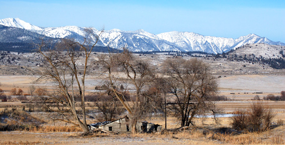
 Steens Mountain Landscape
 Another Steens Mountain Landscape
Since I wrote my comments on wind farms and the new Idaho Power transmission line through Baker County, I have "re-remembered" the effects of poles and other vertical structures as they affect sage grouse. Sage grouse are likely to be listed in the near future as a threatened species due to drastic reductions in their numbers in the last century. Back in the early 1990’s, when I was studying grazing effects on sage grouse in Utah, Clait Braun, a western expert on the grouse, noted that a pole that the BLM had placed over a sage grouse lek in eastern Millard County, Utah, was a perch for raptors who preyed on sage grouse, a species that had been extirpated from the sage grouse mating grounds in question. This lek, believe it or not, was in a BLM special area set aside for sage grouse. My confidence in BLM decisions has been on a downhill slide ever since. Well, it turns out, if you have ever observed where grouse eating raptors like to perch, it is powerlines, like those feeding wind farms into major transmission lines.
Plan to build wind farms near Steens is generating controversy
By Kate Ramsayer / The Bulletin
Published: November 30. 2008 4:00AM PST
Several miles northwest of Steens Mountain in Southeast Oregon, 400-foot-tall turbines would sit on top of ridges, catching the wind and generating enough electricity to power 60,000 houses.
The turbines are at the heart of two proposed projects in Harney County, called the East Ridge and West Ridge wind farms, that would each have a string of between 40 and 69 wind turbines.
While some portions of the wind farms would be located within the boundaries of the Steens Mountain management area, they would be built on private property.
Harney County has given a preliminary OK to the projects, but some environmental groups and wildlife agencies are concerned about whether people know enough about the environmental and visual impacts of wind turbines in the unique area to move forward.
To address those concerns, Columbia Energy Partners, the developer of the wind farms, is working on additional studies, slated to be released this week, that will focus on wildlife, views and socioeconomic impacts, and the county planning commission will hold another hearing on the proposals Dec. 17.
“Our primary concern has been the lack of information that was submitted in the original proposal,” said Brent Fenty, executive director of the Bend-based Oregon Natural Desert Association.
While wind developers in the Columbia Gorge have drawn up voluntary guidelines for projects, many of those guidelines weren’t addressed by the Steens Mountain wind developers when the first hearing was held Aug. 20, he said.
“Some of these areas are ecologically sensitive, and because this is renewable energy and something that we all expect is done ‘green,’ there’s an expectation that they balance environmental impacts with the development,” Fenty said.
Turbines can strike and kill birds and bats, and their construction and maintenance can disturb elk, deer and pronghorn, he said. The developer needs to take a look at the effects of the project, and show that these turbines won’t have a substantial impact on the environment, Fenty said.
“We’re very supportive of renewable energy development,” he said. “But it doesn’t need to happen everywhere, and we need to be very thoughtful about where we site renewable energy (projects),” he said.
The Steens area is a new one for wind projects, said Jerry Cordova, a biologist with the U.S. Fish and Wildlife Service.
“Because this is a unique area,” he said, “we don’t know much about what the impacts of wind development in that area would be. There’s interest in making sure we have the right information before we make a decision.”
And near Steens, biologists might have new issues to deal with — officials are considering listing sage grouse under the federal Endangered Species Act, and the chicken-like birds’ habitat overlaps with some turbine sites.
A sage grouse lek — an area where the birds strut and display during mating season — is considered irreplaceable habitat by the Oregon Department of Fish and Wildlife, said Bob Hooton, Klamath and Malheur Watershed manager with the state agency.
The agency recommends against building wind turbines within three miles of them. And a “significant” part of the West Ridge project is within three miles of a lek, Hooton said.
“It’s our assessment that the wind tower itself, and all of the activity around it from the wind tower operating, will be enough disturbance to the birds that (the) particular breeding area and nesting area will basically be extirpated,” or wiped out, he said.
Biologists don’t know much about how sage grouse will fare near wind facilities, he said. So while agency staff recommended the county not approve turbines near the lek, they added that if the project was approved, the developers should conduct detailed studies of the birds.
But the county, which is not required to follow ODFW’s recommendations, gave the preliminary OK without those suggestions, Hooton said.
While the wildlife agencies could help developers draw up plans to lessen the impacts on sage grouse and other wildlife, it’s hard to do that without knowing what the impacts are, Cordova said.
“The bottom line is that there are a number of concerns about the project, and the concerns are there because of a lack of information,” he said. “It may have limited impact ... but we don’t know, and it’s going to be approved (by the county) before we know. That’s kind of the quandary we’re in.”
Columbia Energy Partners asked for an extension on the planning commission’s decision to address these and other concerns, said Chis Crowley, the Vancouver, Wash.-based company’s president. And the company will soon file additional materials, he said, including bird studies where wildlife biologists counted birds and mapped habitat.
On East Ridge, birds are scattered throughout the site, he said, “but there’s no particular ‘oh-my-God’s’ out there to be worried about.”
On West Ridge, sage grouse do live in the area with turbines, and the company will come up with a plan to make up for the disrupted habitat, he said. The lek will be an issue, he added, but there are no scientific studies on the effect of wind turbines on sage grouse leks three miles away.
“There are very few areas that have wind as good as this area,” he said. “I think a circle on a map is not the best way to make wildlife policy. Certainly sage grouse don’t know where three miles is.”
Views from Steens
Concerns surrounding the Steens projects extend beyond the potential environmental impacts.
Steens Mountain, a 9,670-foot fault block, is the focal point of the Steens Mountain Cooperative Management and Protection Area, which was created after federal and state officials and local landowners agreed on legislation to protect the area.
Some people are worried about the visual impacts of turbines on what’s considered a “crown jewel of the High Desert,” said Fenty, with the natural desert association, since it’s a landscape that many people love.
“That’s a tough decision that I think we all face with wind energy,” he said. “We have to balance the desire for clean renewable energy with visual impacts. That’s a piece of the puzzle we’ll be looking at.”
The developers could modify the projects to move individual turbines that would stand out, and also work on issues like the lighting surrounding the towers, he said.
The visual impact is subjective, said Crowley, of Columbia Energy Partners.
The turbines will be visible to the north from the Kiger overlook and the Steens Summit overlook, but the nearest ones will be three to four miles away, and some will be hidden by other ridges.
The company is working on visual simulations of what the towers will look like, he said, which could be sent to the county next week.
The visual impacts will be part of the planning commission’s ultimate decision on the project, said Brandon McMullen, planning director for Harney County.
“The idea that they’re on one of the ridgelines of the Steens — it’s no secret, some people aren’t going to like that ... It’s a part of the area that everyone loves,” he said.
But there are other factors to consider, he said. At the first planning commission hearing on the matter, there was not one local person or group who gave testimony against the project.
While parts of the projects are within the Steens Mountain Cooperative Management and Protection Area, they’re on private land. It doesn’t appear that the Bureau of Land Management has any say about what kinds of development can be built on private land, even within that area, said Skip Renchler, realty specialist with the BLM in Burns.
“I don’t know anywhere where (the Steens Mountain Act) would extend our reach to the private lands, to be able to say, ‘Hey, you can’t do that,’” he said. “It’s kind of an interesting situation.”
Sizing the projects
The size of the two projects has also drawn questions.
In Oregon, wind projects that generate more than 105 megawatts of power require permission from the Oregon Energy Facility Siting Council.
Projects below that threshold only need approval from county government.
The two projects north of Steens are each 104-megawatt facilities and are both being developed by Columbia Energy Partners.
Columbia Energy has plans for another 104-megawatt wind farm in the same area, sparking concerns that the proposals are actually part of one big wind farm.
This is happening elsewhere in Oregon as well, said Lou Torres, spokesman for the Oregon Department of Energy, and it’s a concern to the state agency.
“We are noticing that there’s some developments out there that are just below the minimum for statewide siting, and we think that they are gaming the system a little bit,” he said.
The perception is that the state’s process takes longer to go through than the county’s permitting process, Torres said, but the state doesn’t think that’s the case.
Still, if a company submits two separate applications, all the state can do is advise the county on what Oregon considers the standards for wind facilities should be, he said.
“If it’s below 104 megawatts, there isn’t anything we can really do except work with the county and answer their questions,” Torres said.
Crowley said that the two projects are, in fact, separate, and will have separate land ownership, power sales agreements, financing, substations and transmission agreements.
Even if the project does get approved by Harney County, he said, there are still a list of things the company has to line up before the project kicks off, like getting financing in a tough economic climate, completing more environmental studies and determining how to get the power from the turbines to the electrical grid.
But, Crowley said, “We’re convinced that the Harney County wind resource is one of the best in the state.”
And the community has been supportive of the wind projects, he said.
Harney County Judge Steve Grasty said he can’t talk about the proposed projects because he could have to make a decision if the projects are appealed. But he said that with the already-approved Echanis project, the No. 1 benefit is that wind power allows ranches to stay in one piece.
“Keeping land blocked up beats the heck out of a subdivision,” he said.
And in addition to providing a big increase in the tax base, Grasty said, the wind projects give residents hope and opportunities for the future.
Columbia Energy’s Crowley said President-elect Barack Obama regularly talks about building a ‘green’ economy and generating more energy from renewable sources.
“Why the heck shouldn’t Harney County be an addition to that?” he asked.
Kate Ramsayer can be reached at 541-617-7811 or kramsayer@bendbulletin.com.
Blog Notice:
IN ACCORDANCE WITH TITLE 17 U.S.C. SECTION 107, THIS MATERIAL IS DISTRIBUTED WITHOUT PROFIT TO THOSE WHO HAVE EXPRESSED A PRIOR INTEREST IN RECEIVING THE INCLUDED INFORMATION FOR RESEARCH AND EDUCATIONAL PURPOSES.
 Fritillary on Steens Mountain
Planning hearing
The Harney County Planning Commission will hold a hearing on the East Ridge and West Ridge wind farms at 7 p.m., Dec. 17, at the Harney County Courthouse, 450 N. Buena Vista Ave., Burns.
 Wildhorse Lake, Steens Mountain
__________________________________
Comments on New Baker County Transmission Lines
November 14, 2008
Christopher Christie
1985 15th Street
Baker City, OR 97814
refugee2000@gmail.com
541-523-2376
Oregon Department of Energy
Adam Bless, Energy Facility Analyst
625 Marion St. NE
Salem, OR 97301
Adam.bless@state.or.us
Phone: 503-378-8692
1-800-221-8035
RE: The Boardman to Hemingway Transmission Line Project
Dear Mr. Bless:
Please accept these comments on the Boardman to Hemingway Transmission Line Project.
I live in Baker City, Oregon, and I am generally familiar with much of the area covered by the proposed routes due to my participating in raptor and other bird counts throughout Baker County, and due to my work monitoring conditions in the Pritchard Creek, Holman Creek, Sardine Creek, Ritter Creek, and Ruckles Creek watersheds for Hells Canyon Preservation Council. I participated in the plant surveys done for the new transmission line that will go from the Elkhorn Valley Wind Farm to the La Grande substation near the cemetery there.
After reading about the project, looking over the Oregon Energy Facility Siting Standards, and the maps provided on November 7, 2008, I have the following preliminary comments and concerns about the project.
Except for some modifications to the portion East and North of Baker City, I generally agree that the proposed route is the best of all the alternative and considered routes because it has the least impact on fish and wildlife habitat, significantly less impact on a species which is likely to be listed as threatened in the near future (sage grouse), will have the least impact on scenic and aesthetic resources that have been identified as visual resources by the BLM and Forest Service, would have no impact on historic, cultural or archeological resources that would be significantly different those of other alternatives, would have the least impact on recreational opportunities in the surrounding areas, and because it is over a shorter, established route, it would minimize waste production and carbon emissions more than the other alternatives.
In relationship to the Council's siting standards, my primary reasons for favoring the proposed route are the following:
Fish and Wildlife Habitat Standard
345-022-0060
“Fish and Wildlife Habitat
To issue a site certificate, the Council must find that the design, construction and operation of the facility, taking into account mitigation, are consistent with the fish and wildlife habitat mitigation goals and standards of OAR 635-415-0025 in effect as of September 1, 2000.”
Centrocercus urophasianus, the sage grouse, is listed by the Federal Government as a species of concern, and is currently undergoing review for consideration as a threatened species. Many avian authorities already consider it threatened, and feel it will likely be listed in the near future, even though the US Fish and Wildlife Service did not list it in the previous review under the control of an agency that has become politicized by the Bush administration. The state of Oregon list this species as “SV,” that is "Vulnerable" sensitive species are not in imminent danger of being listing as threatened or endangered, but could become "sensitive-critical," "threatened," or "endangered," with changes in populations, habitat or threats.” This is especially so with regard to the populations in the area traversed by the Keating alternative, the one that is seen in green on the “Boardman to Hemingway” Baker County Biological Resources Map.
Given the uniqueness and significance of this resource, one might wonder why this route was even proposed, as it would traverse through the center of one of the largest chunks of occupied sage grouse habitat in the County between Interstate 84 and the Union County line. The construction of the transmission lines and road through the habitat attempts to snake through between Category 1 sage grouse lek buffers over Category 2 sage grouse habitat, but brushes up against Category 1 habitat in several places. If constructed on this alternative route, it will further fragment and divide the largest chunk of Baker County’s remaining sage grouse habitat in two. Habitat fragmentation is well known to be a primary cause of species extirpation and extinction (Michael Soule et al. 1992).
For Category 1 sage grouse habitat, the mitigation requirement for this project is “no loss of either habitat quantity or quality.” It is doubtful, given the close proximity of the Keating alternative route to Category 1 habitat, that this mitigation goal could be achieved due to the permanent nature of the facilities, construction noise and damage, and habitat quality and quantity loss due to fragmentation. The state of Oregon requires “Avoidance of impacts through alternatives to the proposed development action, or authorization of the proposed development action if impacts cannot be avoided.” An alternative exists in the proposed alternative, with modifications, so the Keating alternative route should be not be further considered.
For Category 2 sage grouse habitat, the mitigation requirement for this project is “no net loss of either habitat quantity or quality and to provide a net benefit of habitat quantity or quality.” By definition, all other suitable sage grouse habitat in the County is currently occupied, otherwise it would not be suitable. Sage brush communities in which sage grouse make their home are diminishing and are under serious threat from many uses throughout the range of the sage grouse. In addition, there are few if any examples of effective restoration of sage grouse habitat that have been accomplished in a timeframe that would be useful to this declining species. Mitigation through restoration of potential habitat is an empty promise as would be any assurance “to provide a net benefit of habitat quantity or quality.” In this case, there must be an “Avoidance of impacts through alternatives to the proposed development action.” An alternative exists in the proposed alternative, with modifications, so because of this Category 2 habitat, as is the case in the Category 1 habitat, the Keating alternative route should be not be further considered.
In addition to Category 1 and 2 Sage grouse habitat, the alternative Keating route also traverses many more miles of high quality Category 2 deer and elk winter range than does the proposed route. The proposed route comprises mostly deer winter range and is along lesser quality habitat in the I-84 corridor and near an active railroad line. It would have significantly less impact on elk and deer.
The proposed Keating route simply is not consistent with the fish and wildlife habitat mitigation goals and standards of OAR 635-415-0025, and cannot meet the Fish and Wildlife Habitat Standard. An alternative exists which can meet the standard with modifications, and that is the proposed route.
To meet the standard, the proposed route would simply need to either move slightly to the west of the proposed route where it skirts or goes through the edge of sage grouse habitat on the east side of I-84, or it could circle around the west side of Baker City as an earlier proposal that is no longer being considered. It would need to move fairly close to the freeway in the vicinity of Magpie Peak.
Scenic and Aesthetic Values Standard
345-022-0080
“Scenic Resources
(1) Except for facilities described in section (2), to issue a site certificate, the Council must find that the design, construction and operation of the facility, taking into account mitigation, are not likely to result in significant adverse impact to scenic resources and values identified as significant or important in local land use plans, tribal land management plans and federal land management plans for any lands located within the analysis area described in the project order.”
There is no doubt that the proposed transmission lines will be an eyesore for most people, no matter where they are located.
Recently, the viewshed of the BLM’s Oregon Trail Interpretive Center has been mentioned as an issue by opponents to the proposed route, and has surfaced as a possible overlay in Baker County’s proposed Draft zoning ordinances. This is ironic, as the visitor center itself degraded the view of the previously undeveloped line of sagebrush hills it sits on as they are seen from the Baker Valley.
The “Boardman to Hemingway” Baker County Visual Resources Map shows no indication that BLM resource plans have identified the view from the visitor center as a visual resource, although it is a good vantage point to look down upon the existing transmission lines, Interstate 84, the airport, the Union Pacific Railroad, and development in the City of baker City. The only route that encroaches on an identified BLM visual resource is the Keating alternative where in crosses a BLM VRM Class 2 visual resource in the Powder River Valley south east of Keating. According to the map, “The objective of this class is to retain the existing character of the landscape.
Management activities may be seen, but should not attract the attention of the casual observer.” The Keating alternative, because of the gargantuan size of the towers, would attract even the sleepiest person’s attention and thus violate this objective. It is therefore a “significant adverse impact to scenic resources and values identified as significant or important” by the BLM and the Keating alternative should be rejected by the BLM and the Oregon Siting Council.
It should also be noted that the vistas and lack of development offered in the grass/sagebrush communities the Upper Holman and upper Pritchard Creek drainages are as dramatic, scenic. unique, and unspoiled as almost any other in the south County.
Historic, Cultural or Archeological Resources Standard
345-022-0090
Historic, Cultural and Archaeological Resources
(1) Except for facilities described in sections (2) and (3), to issue a site certificate, the Council must find that the construction and operation of the facility, taking into account mitigation, are not likely to result in significant adverse impacts to:
(a) Historic, cultural or archaeological resources that have been listed on, or would likely be listed on the National Register of Historic Places;
(b) For a facility on private land, archaeological objects, as defined in ORS 358.905(1)(a), or archaeological sites, as defined in ORS 358.905(1)(c); and
(c) For a facility on public land, archaeological sites, as defined in ORS 358.905(1)(c).
While he existing transmission line and transportation corridors, along which the proposed route would be placed, are fairly well studied and degraded, the Keating route is not. The proposed route only impacts the Oregon Trail in the southern portion NW of Durkee in T11S R42E and T10S R42E, and where it will span the trail west of the interpretive center. The alternative Keating route also follows the trail NW of Durkee, and impacts two ACECs NE of Keating. The view from the Baker City historical sites is already degraded by the interstate and other development, not to mention the non-historic sections and new development in Baker City, so the new transmission towers would not change the impact significantly. The contrast can only favor the historic district and help people understand the changes that have occurred. Ditto for the visitor center. Damage to the trail to the west of the visitor center should be minimal or non-existent as the towers can be placed away from the trail and the lines will be far above it. Physical damage to the Oregon Trail from visitors responding to publicity provided by the visitor center is far greater in the long run than any that could possibly be done by the presence of the transmission lines.
Recreation Standard
345-022-0100
Recreation
(1) Except for facilities described in section (2), to issue a site certificate, the Council must find that the design, construction and operation of a facility, taking into account mitigation, are not likely to result in a significant adverse impact to important recreational opportunities in the analysis area as described in the project order. The Council shall consider the following factors in judging the importance of a recreational opportunity:
(a) Any special designation or management of the location;
(b) The degree of demand;
(c) Outstanding or unusual qualities;
(d) Availability or rareness;
(e) Irreplaceability or irretrievability of the opportunity.
The vistas and lack of development offered in the grass/sagebrush communities the Upper Holman and upper Pritchard Creek drainages make it a popular destination for hunters, naturalists, photographers, and solitude seekers. Because it is somewhat less accessible, compared to other undeveloped areas in the County, it offers outstanding opportunities for both solitude and hunting. It has spring wildflower displays that are unique and relatively unspoiled, and is along the migration route for snow geese and other birds. These qualities, along with unobstructed scenic.vistas of the Elkhorns, Wallowas, and Dooley Mountain, make it an outstanding recreational experience. The placement of such a visible power transmission facility through such wild country would be an impact that would seriously degrade many recreational experiences that can be found in that area.
Waste Minimization Standard
345-022-0120
Waste Minimization
(1) Except for facilities described in sections (2) and (3), to issue a site certificate, the Council must find that, to the extent reasonably practicable:
(a) The applicant’s solid waste and wastewater plans are likely to minimize generation of solid waste and wastewater in the construction and operation of the facility, and when solid waste or wastewater is generated, to result in recycling and reuse of such wastes;
(b) The applicant’s plans to manage the accumulation, storage, disposal and transportation of waste generated by the construction and operation of the facility are likely to result in minimal adverse impact on surrounding and adjacent areas.
The proposed route, even with modifications to largely avoid sage grouse habitat, appears to be the shortest route. Less material would be necessary for the project so less solid waste should be produced. Due to the proximity to the freeway and disposal sites, less waste accumulation should occur. Accumulation of waste could occur on currently existing previously degraded sites, as exist at Lime and in areas near the freeway east of baker City. Part of the route is within a few miles of the large disposal site south of Baker City. The Keating alternative would be more likely to result in the generation of more solid waste because it is longer and will use more materials. The Keating alternative also would be more likely to result in adverse impacts to the surrounding area as it is relatively pristine and is not in close proximity to existing previously degraded sites, the freeway, or legal disposal sites.
Carbon dioxide emissions
Because the proposed route is shorter, and because of its proximity to the Interstate, disposal sites, possible waste accumulation sites, and worker residences, vehicles and equipment used in the construction phase of the project on the proposed route can be expected combust less fossil fuel than vehicles and equipment that would be used in the construction phase for other alternative routes. Therefore, all other things, like motor efficiency, being equal, the proposed route should result in fewer carbon emissions than any of the current alternatives.
These are all the concerns I am aware of at this time. I will add additional comments if I become aware of new information that would raise concerns. Please keep me informed of any changes made to the proposal as the process progresses and please notify me of any additional opportunities to comment on the Boardman to Hemingway Transmission Line Project.
Forgive me for any grammatical, spelling or other errors in this document. It is getting late in the day and I must send them in to meet the deadline. If errors come to my attention, I will send in corrected copies.
Thank you,
Sincerely,
Christopher Christie
CC:
Lucas Lucero, Federal Project Manager, BLM
Nancy Lull, Baker County Resource Area Manager, BLM
Hells Canyon Preservation Council
Oregon Natural Desert Association
Baker County Planning Director
Baker City Manager
Baker County Blog
Baker City Council
_______________________________
Comments on New Baker County Planning Ordinance
November 12, 2008
Christopher Christie
1985 15th Street
Baker City, OR 97814
refugee2000@gmail.com
541-523-2376
Mark Bennett
Baker County Planning Director
1995 Third Street
Baker City, OR 97814
Phone: (541) 523-8219
mbennett@bakercounty.org
RE: 2008 BAKER COUNTY ZONING ORDINANCE REVISION
Dear Director Bennett, Holly Kerns, Tara Andrews, and other responsible public officials:
Please accept these comments on the 2008 Baker County Zoning Ordinance Revision.
After finding some time to look over a small portion of the proposed revisions, I have the following preliminary comments and concerns about the process and the revisions.
My understanding is that it took County Planners and a consultant 5 years or so to develop the revisions. The papers first notified the public about the revisions in about mid-August, there were several informational meetings held, and a few uninformative newspaper articles that appeared between then and the first hearing on November 13, 2008. There was little in the way of in-depth reporting by the local papers or mailings by the County, that might have educated citizens as to any issues other than the transportation element. So, during the busy fall period, when in addition to their normal work load, many citizens are out hunting, gathering fire wood, putting their garden to bed, winterizing their homes, reading about the ballot measures and election candidates, etc., etc., they were expected to digest revisions to some 274 sections of 42 or so chapters of county planning code. How can it be that the County would expect people, with all their other responsibilities, to get this done in 3 months, when it took the County 5 years to come up with the revisions? Why weren’t citizens more informed of the changes as they were developed?
The County made a few copies available, and had the draft revisions available for download from the County web site. To view the revisions on a computer, taxpayers had to separately download and save each of the approximately 274 sections of the 42 or so chapters. I am told it takes about 8 hours to accomplish the formidable task—it would have taken me longer. Why didn’t the County provide one document for download so that the process would go quickly and citizens could readily access the chapters and sections in a single document? These are unnecessary hurdles people need to jump just to get access to the information, and these difficulties have the effect of discouraging them from participating in the process. With the relatively inexpensive Adobe Acrobat software that is available today, there can be little excuse for not providing the information in a single document that citizens could very quickly download in one piece. Why did the County raise these obstacles to public participation?
In addition, the draft revision document makes reference to other documents, eg., “Section 205.06, Type III Procedures,” but the public is not given any idea of where they can find and read such references.
The county is providing one hearing for the changes to the transportation element chapter, and is allowing only Thursday night’s hearing for all the 40 or so other chapters. Allowing so little time to hear the concerns of the public about so many chapters, gives the proceeding the appearance of a charade.
With the limited time available to me at this time of year, I have cobbled together the following requests and specific comments about some of the revised chapters I have been able to look at.
- Extend the Process and Comment Period
The hearing process and comment period should be extended to allow people to become more familiar with the revisions. What’s the rush? Winter freeze-up is about upon us, and things won’t go to hell in a hand-basket if we have a few more months to consider the issues during the slower winter period.
- Chapter 640 Sensitive Bird Habitat
The sensitive bird habitat overlay revision is a positive step forward, or at least a good starting point, in helping to help preserve Baker County’s avian wildlife heritage, and hopefully will provide the minimum protection required by sensitive bird populations. I assume consultation with ODFW will require development proponents to comply with OAR 635-415, Oregon’s FISH AND WILDLIFE HABITAT MITIGATION POLICY. If not, compliance with the state mitigation policy should be made explicit in the revised requirements.
State and Federal agencies are generally understaffed and have very full schedules. The review period should be at least 20 working days, with reasonable extensions granted if they require them. If they have not responded, or requested an extension by the end of 20 working days, only then should it be determined that they have no concerns about the proposed land use.
- Chapter 620 Big Game Habitat Overlay
Conserving and protecting Baker County’s big game species requires more than a token 40 acre minimum parcel size. Many other counties maintain a more adequate amount of winter range habitat by requiring a minimum parcel size of 160 to 320 acres. Larger minimum parcel sizes should help reduce the incidence of human interaction with predators by keeping human density lower in valuable big game winter range. Larger winter ranges should also provide for healthier herds of big game animals as well.
State and Federal agencies are generally understaffed and have very full schedules. The review period should be at least 20 working days, with reasonable extensions granted if they require them. If they have not responded, or requested an extension by the end of 20 working days, only then should it be determined that they have no concerns about the proposed land use.
- Chapter 650 Oregon Trail Interpretive Center Overlay
Existing Utility and transportation corridors to the west of the Interpretive Center corridors should be exempt from the viewshed overlay requirements. The development with in the Baker City urban boundary, existing utility corridors, the airport, freeway, and other development in the Baker Valley, already detract from any values associated with an historic sensibility that might be gained in that direction, and with the view of the OHV area and Highway 86 to the south east, the views to the east and north provide people a sense of how development has changed the landscape since the time the Oregon Trail was in use by the pioneers. The horse in the barn had been replaced by cars and big rigs by the time the interpretive center was built, and, in any event, the interpretive center itself detracts from the viewshed and any lingering historic feel of the area.
State and Federal agencies are generally understaffed and have very full schedules. The review period should be at least 20 working days, with reasonable extensions granted if they require them. If they have not responded, or requested an extension by the end of 20 working days, only then should it be determined that they have no concerns about the proposed land use.
- Chapter 660 Wetlands Overlay
I support Leslie Gecy’s comments regarding the wetlands overlay. I have read her comments and as a wetlands specialist, she is well qualified to comment on the subject.
- Chapter 750 Wind Towers
This chapter might be better titled “Wind Power Generation Facilities.”
Under Purpose, the first sentence states: “Baker County recognizes valuable wind power resources are in rural areas.” This sentence might become a little more relevant if it stated: “Baker County recognizes valuable wind power resources occur in our rural areas.” This section also states that “Development of these resources will provide jobs, will expand the local tax base and will keep energy dollars in the local area.” This sentence seems inappropriate, or at least incomplete, and makes assumptions that are not further supported with any factual information. As it does not discuss or recognize any negative impacts associated with wind power development, one gets the impression that the County is only interested in promoting wind power by making unexamined claims for alleged benefits from such development. Therefore, it lacks balance.
How many jobs will be produced, and their duration, is not discussed. How the tax base will be expanded and how many energy dollars, if any, will remain in the area, is not documented or explained. Decision makers, and the affected public, is given no basis for weighing the net effects of such development. Wind power development may well be positive, and perhaps the conclusion by the County that it should be encouraged is correct, but the purpose of zoning regulations is to assess the net effects, and to balance whatever good that can be provided by such development against the negative effects to other values, such as maintaining natural healthy habitat and landscapes, rather than producing industrialized ones.
Under the section titled “Definitions,” the word “community” is used under subsection C:
“C. Community Wind Power Generation: An activity carried out using one or more wind turbine generators operated as a single commercial wind power generation facility that has a combined generating capacity of less than 10 MW.”
It is not clear why this should not be titled “Low Output Wind power Generation.” What does the community have to do with it? Is our “community” sharing in the investment and the power these facilities generate? If not, the word community in the current context seems to be misused.
Under the Conditional and Permitted Uses sections, the draft revision document makes reference to other documents, eg., “Section 205.06, Type III Procedures,” but the public is not given any idea of where they can find and read such references.
Under the section titled “ Construction Standards,” subsection 1-9 reads, “Reasonable efforts shall be taken to protect and to preserve existing trees, vegetation, water resources, wildlife habitat or other significant natural resources.” Perhaps the phrase “in accordance with all applicable State and Federal laws” should be added at the end. It would be helpful if an attempt to describe what the “reasonable” efforts might be and how it is defined.
Under the section titled “Application Requirements,” subsection 1-6 states:
“6. Copies of all baseline wildlife studies applicable to the project site.” (will be included)
This subsection should include plant studies and a requirement that the studies be done by a firm or individual with demonstrated competence and experience in the field, either through formal education, experience, or a combination of both, to accurately assess the area and complete the study. The same competence requirements for necessary studies identified in other subsections should apply to those subsections as well.
Subsection 1-8 refers to a revegetation plan for areas disturbed during construction. A bond should be required to ensure that funds are available to finance any necessary revegetation required under this subsection.
An additional subsection requiring habitat mitigation, in accordance with OAR 635-415 should be included in this chapter. Consultation requirements with ODFW, and proof of ability to provide financing for mitigation, or bonding, should be included.
Subsection “D. Avian Plan,” should include a requirement for bird and bat strike/mortality monitoring, including a plan to provide financial assurances that the monitoring will be completed and reports issued by independent firms with demonstrated expertise or the necessary education to perform avian and bat monitoring. In addition, if mortality exceeds a level that ODFW and/or Federal authorities, such as the Fish and Wildlife Service, etc., find acceptable, decommissioning or mitigation consultations with applicable state and federal agencies must be required to be initiated in order to reduce the fatalities to an acceptable level. The reason such monitoring is necessary, is that migratory bats, for example hoary bats (Lasiurus cinereus), and silver-haired bats (Lasionycteris noctivagans), both of whom occur in Baker County, are turning up dead at wind turbine sites all over the world. (see: http://www.fort.usgs.gov/BatsWindmills/ ) The USGS report states that “several of these sites are estimated to cause the deaths of thousands of bats per year.” Wind power facilities have well documented mortality effects on birds as well.
All other plans in this chapter, including the erosion control and weed control plans, should be accompanied by financial assurances such as a bond or pay as you go fund, so that the County, and its residents, can be assured that such plans can be carried to completion.
All information to be provided under subsection K, 1 through 4, should be required to be provided by competent firms, individuals, or other authorities, as described above.
- Chapter 760 Home Occupations
Subsection B-4, Participants
This subsection would not allow remote employees who are not “members of the immediate family residing on the premises” to be employed in a Type I Minor Home Occupation. That seems arbitrary and capricious, as the impacts to the residence, roads, and the neighborhood would be less than those of the family members employed. Remote employees, who have no need to regularly travel to the business site, have little impact on the business site or neighborhood it is in, and should be allowed under this subsection. In addition, it would be unnecessary for the home business to provide employee or client parking spaces, as they visit the home business very infrequently.
- Additions
Baker County’s sensitive plants have much less protection than they need and deserve. We should work on a sensitive plant overlay to go along with our big game and sensitive bird overlays. Also, perhaps we could develop an “other sensitive biota” overlay that would cover other variously threatened organisms.
These are all the comments I have time for given the County’s unnecessarily truncated comment period.
I would like to be kept appraised of opportunities to further participate in the revision process as it progresses and to be notified of any additional opportunities to comment.
Thank you,
Sincerely,
Christopher Christie
CC: Hells Canyon Preservation Council
______________________________________
The More Things “Change” . . .
(Reality Check--Part Four) will have to wait ‘til later this week.
No comments:
Post a Comment